Missouri Geological Survey
Display Map Information
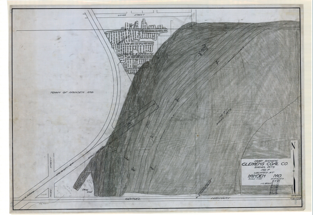
County: Barton
Map Number: 01512
Mine Name: North & Lecomte Mine
Map Title: Map Showing Clemens Coal Co., Shovel Pits No. 7, Located at Minden Mo.
Map Image: MAP IMAGE
Scale: 1" = 100'
Township: 31N; 32N
Range: 33W; 33W
Section: 5; 32
Commodity: Coal
Company Name: Clemens Coal Co.
Author: J.C. Brown
Date: 1931
Purchase: High-resolution electronic and paper maps are available for purchase by calling 573-368-2100