Missouri Geological Survey
Display Map Information
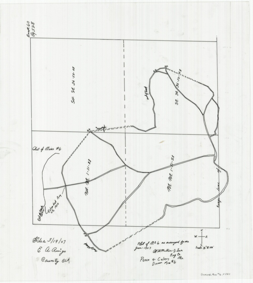
County: Ray
Map Number: 01296
Mine Name: Mine No 6, Diamond Mine #6
Map Title: Plat of Mine No 6 as surveyed by me Jan - 1907
Map Image: MAP IMAGE
Scale: 1" = 200'
Township: 51N; 51N; 52N; 52N
Range: 26W; 28W; 27W; 28W
Section: 6; 1; 31; 36
Commodity: Coal
Company Name: Pence & Calvin
Author: W.A. Mullin
Date: 1910
Purchase: High-resolution electronic and paper maps are available for purchase by calling 573-368-2100