Missouri Geological Survey
Display Map Information
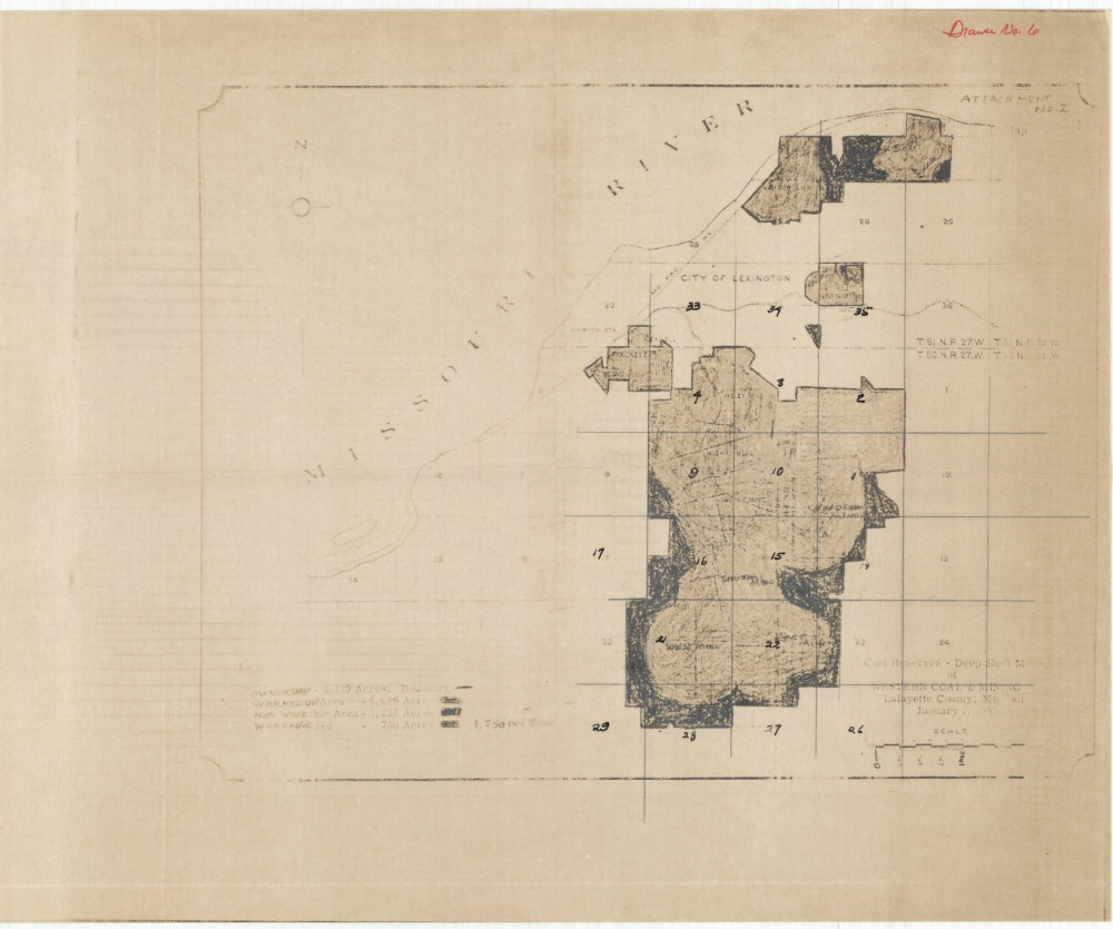
County: Lafayette
Map Number: 01249
Mine Name: McDowell Mine, Oak, Old Shaft 10, Rackett, Valley Mine, Midway Mine, Woodrow Mine, West Mine, East Mine, South Mine, Summit Mine
Map Title: Coal Reserves - Deep Shaft Mining of Western Coal & Mining Lafayette County Missouri
Map Image: MAP IMAGE
Scale: 1" = 1 mile
Township: 50N; 51N
Range: 27W; 27W
Section: 2, 3, 4, 5, 9, 10, 11, 14, 15, 16, 20, 21, 22, 23, 27, 28; 22, 23, 24, 26, 27, 32, 33, 34, 35
Commodity: Coal
Company Name: Western Coal & Mining
Author:
Date: 1952
Purchase: High-resolution electronic and paper maps are available for purchase by calling 573-368-2100