Missouri Geological Survey
Display Map Information
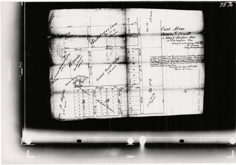
County: Lafayette
Map Number: 01228
Mine Name: Charles Pirner's Coal Mine
Map Title: Coal Mine of Charles M. Pirner
Map Image: MAP IMAGE
Scale: 1" = 100'
Township: 51N
Range: 27W
Section: 27
Commodity: Coal
Company Name:
Author: H. Krause
Date: 1886
Purchase: High-resolution electronic and paper maps are available for purchase by calling 573-368-2100