Missouri Geological Survey
Display Map Information
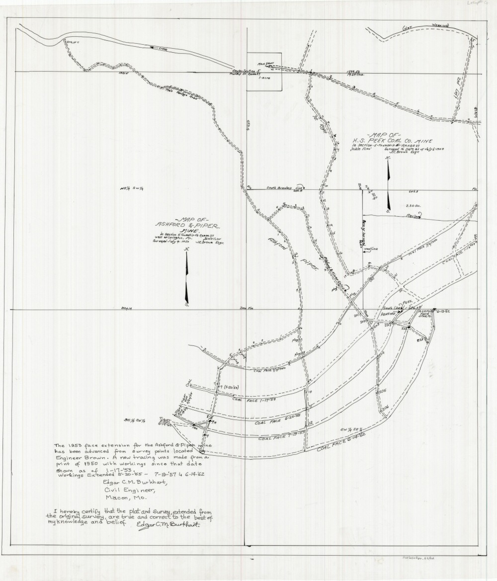
County: Lafayette
Map Number: 01226
Mine Name: Ashford & Piper Mine, H.S. Peek Mine
Map Title: Map of Ashford & Piper Mine; Map of H.S. Peek Coal Co. Mine
Map Image: MAP IMAGE
Scale: 1" = 100'
Township: 50N
Range: 27W
Section: 5
Commodity: Coal
Company Name: Ashford & Piper, H.S. Peek Coal Co.
Author: Edgar C.M. Burkhart, J.C. Brown
Date: 1962
Purchase: High-resolution electronic and paper maps are available for purchase by calling 573-368-2100