Missouri Geological Survey
Display Map Information
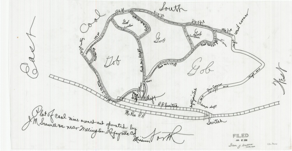
County: Lafayette
Map Number: 01206
Mine Name:
Map Title: Plat of coal mine owned and operated by J.M. Seawell near Wellington, Lafayette, Co Missouri
Map Image: MAP IMAGE
Scale: no scale
Township: 50N
Range: 27W
Section:
Commodity: Coal
Company Name: J.M. Seawell
Author:
Date: 1892
Purchase: High-resolution electronic and paper maps are available for purchase by calling 573-368-2100