Missouri Geological Survey
Display Map Information
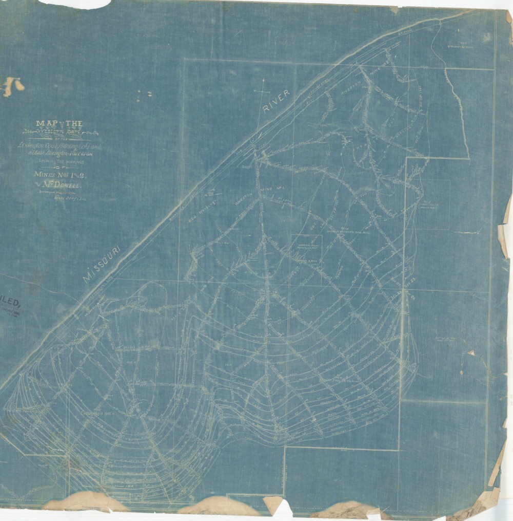
County: Lafayette
Map Number: 01200
Mine Name: Riverton Mine No 1, Riverton Mine No 2, McDowell, Tom Clarks Mine
Map Title: Map of the Western part of the Lexington Coal Mining Cos Land at East Lexington-Riverton, showing the workings of Mines Nos 1 and 2 and Mc Dowell
Map Image: MAP IMAGE
Scale: 1" = 200'
Township: 51N
Range: 27W
Section: 22, 23, 26, 27
Commodity: Coal
Company Name: Lexington Coal Mining Co.
Author:
Date: 1900
Purchase: High-resolution electronic and paper maps are available for purchase by calling 573-368-2100