Missouri Geological Survey
Display Map Information
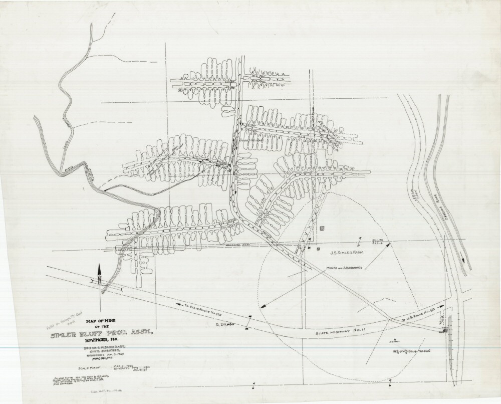
County: Adair
Map Number: 01145
Mine Name:
Map Title: Map of the Simler Bluff Prod. Assn.
Map Image: MAP IMAGE
Scale: 1" = 100'
Township: 61N; 62N
Range: 16W: 16W
Section: 4, 5; 32, 33
Commodity: Coal
Company Name: Simler Bluff Prod. Assoc., J.S. Simler farm
Author: Edgar C.M. Burkhart, P. Bubany
Date: 1946
Purchase: High-resolution electronic and paper maps are available for purchase by calling 573-368-2100