Missouri Geological Survey
Display Map Information
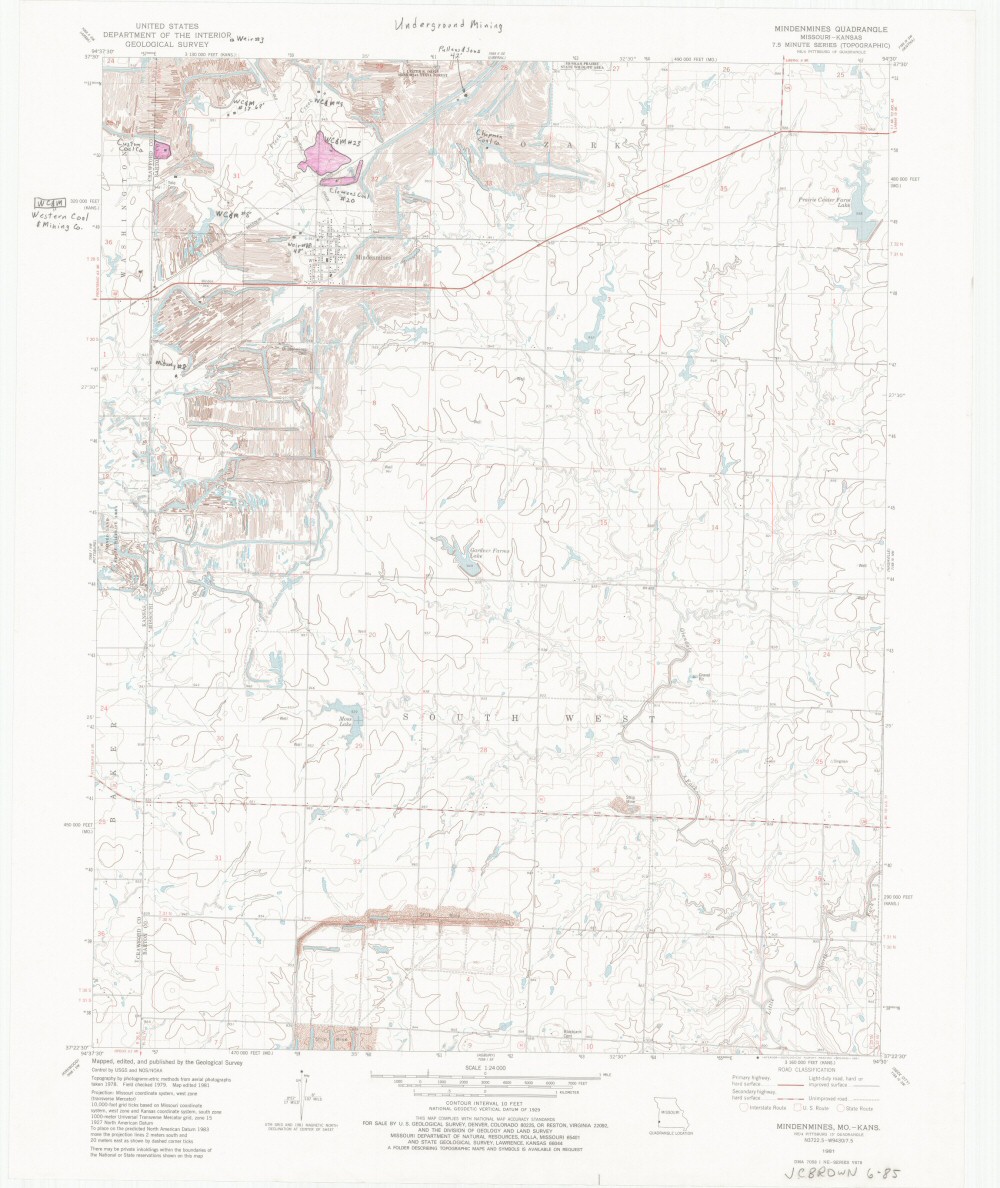
County: Barton
Map Number: 01115
Mine Name: Custom Coal Company Mine, WC&M # 17, WC&M #9, Pullens & Sons Mine, Chapman Coal Company Mine, WC&M #23, Clemens Coal #20, WC&M #8, Weir #18, Midway #8
Map Title: Underground Mining
Map Image: MAP IMAGE
Scale: 1:24,000
Township: 31N; 32N
Range: 33W
Section: 6, 7; 28, 30, 31, 32, 33
Commodity: Coal
Company Name:
Author:
Date: no date
Purchase: High-resolution electronic and paper maps are available for purchase by calling 573-368-2100