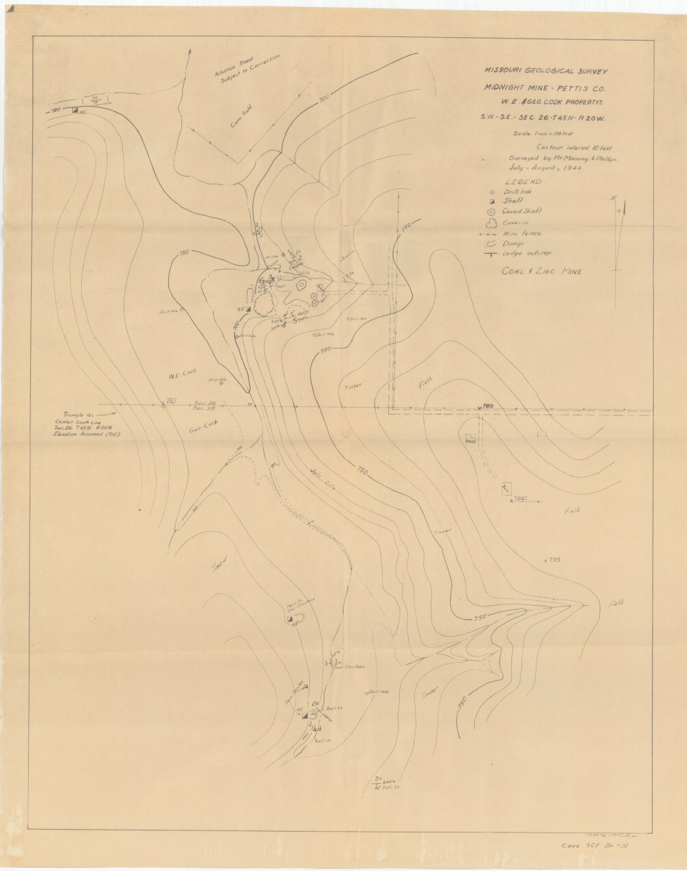
Missouri Geological Survey
Display Map Information
County: Pettis
Map Number: 01101
Mine Name: Midnight Mine
Map Title: Midnight Mine - Pettis Co.
Map Image: MAP IMAGE
Scale: 1" = 100'
Township: 45N
Range: 20W
Section: 26, 35
Commodity: Coal; Zinc
Company Name: W.E. & Geo. Cook Propertys
Author: McManamy & Phillips
Date: 1944
Purchase: High-resolution electronic and paper maps are available for purchase by calling 573-368-2100