Missouri Geological Survey
Display Map Information
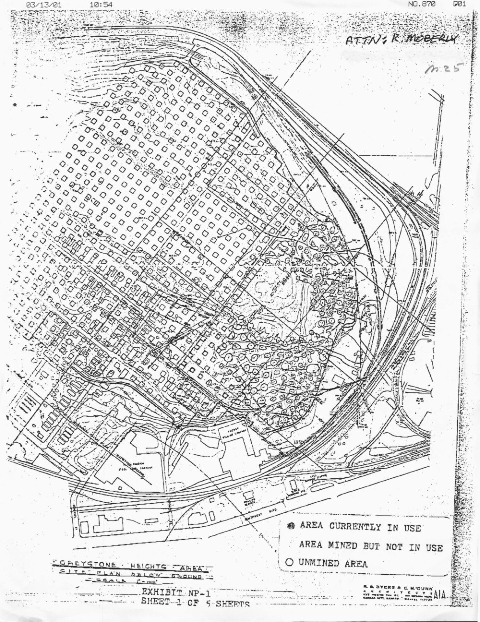
County: Jackson
Map Number: 00910b
Mine Name: Graysone - WY St. Dev. South
Map Title: Graystone Heights area, city plan below ground
Map Image: MAP IMAGE
Scale: 1" = 100'
Township: 49N
Range: 33W
Section: 18
Commodity: limestone
Company Name:
Author:
Date: no date
Purchase: High-resolution electronic and paper maps are available for purchase by calling 573-368-2100