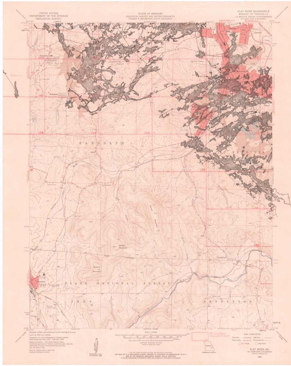
Missouri Geological Survey
Display Map Information
County: St. Francois
Map Number: 00706
Mine Name: Old Lead Belt Mines
Map Title: State of Missouri Flat River Quadrangle
Map Image: MAP IMAGE
Scale: 1" = 1000'
Township: 36N, 37N
Range: 04E, 05E
Section: 01, 02, 03, 04, 05, 07, 08, 09, 10, 11, 12, 13, 14, 24; 05, 06, 07, 08, 17, 18, 19, 20, 29; 32, 33, 34, 35, 36; 31, 32
Commodity: lead, zinc
Company Name:
Author:
Date: 1958
Purchase: High-resolution electronic and paper maps are available for purchase by calling 573-368-2100