Missouri Geological Survey
Display Map Information
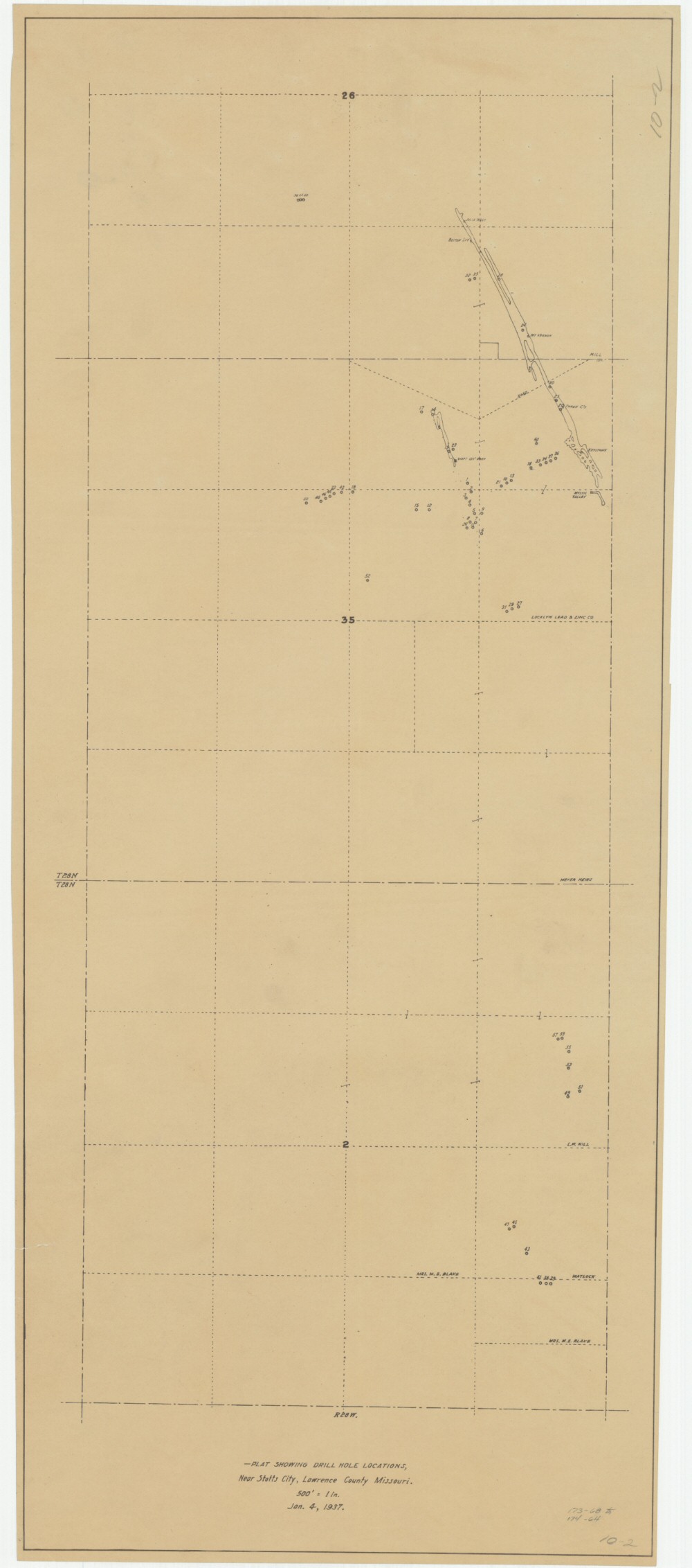
County: Lawrence
Map Number: 00462
Mine Name:
Map Title: Plat Showing Drill Hole Locations, Near Stotts City, Lawrence County Missouri
Map Image: MAP IMAGE
Scale: 1" = 500'
Township: 27N, 28N
Range: 28W
Section: 02; 26, 35
Commodity: zinc, lead
Company Name:
Author:
Date: 1937
Purchase: High-resolution electronic and paper maps are available for purchase by calling 573-368-2100