Missouri Geological Survey
Display Map Information
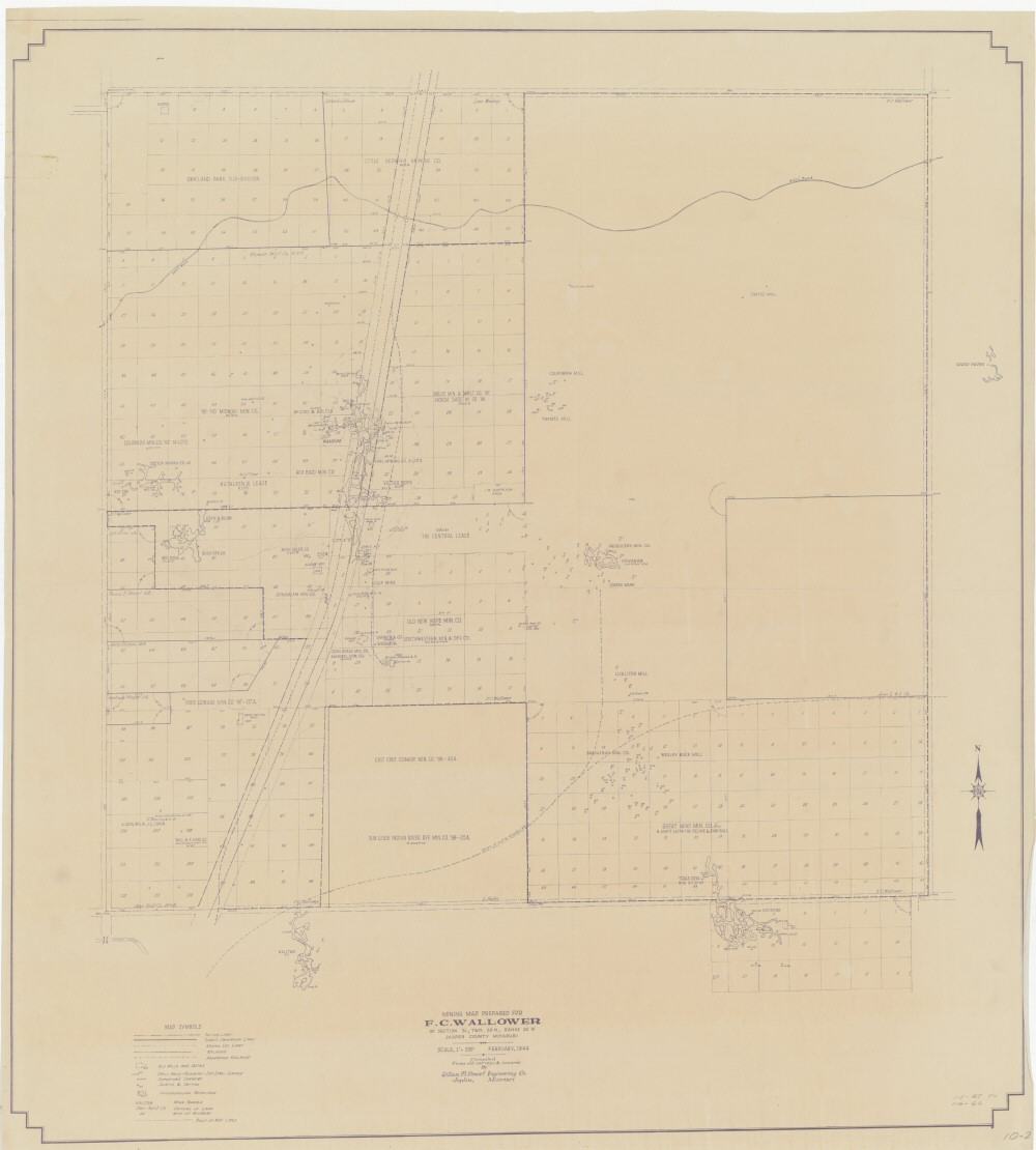
County: Jasper
Map Number: 00439
Mine Name: Steers Mine, Kalitan Mine, Movakan Mine, Wampum Mine, Little "D" Mine, Lilly Mine, Red Fox Mine, Big Dick Mine, Grand Haven Mine, Terra Cota/New Dividend Mine
Map Title: Mining Map Prepared For F.C. Wallower of Section 31, Twp. 28N Range 32W, Jasper County Missouri
Map Image: MAP IMAGE
Scale: 1'"=200'
Township: 27N, 28N
Range: 32W
Section: 06; 31, 32
Commodity: zinc, lead
Company Name: *numerous companies
Author: William M. Stewart Engineering Co., Joplin Mo
Date: 1944
Purchase: High-resolution electronic and paper maps are available for purchase by calling 573-368-2100