Missouri Geological Survey
Display Map Information
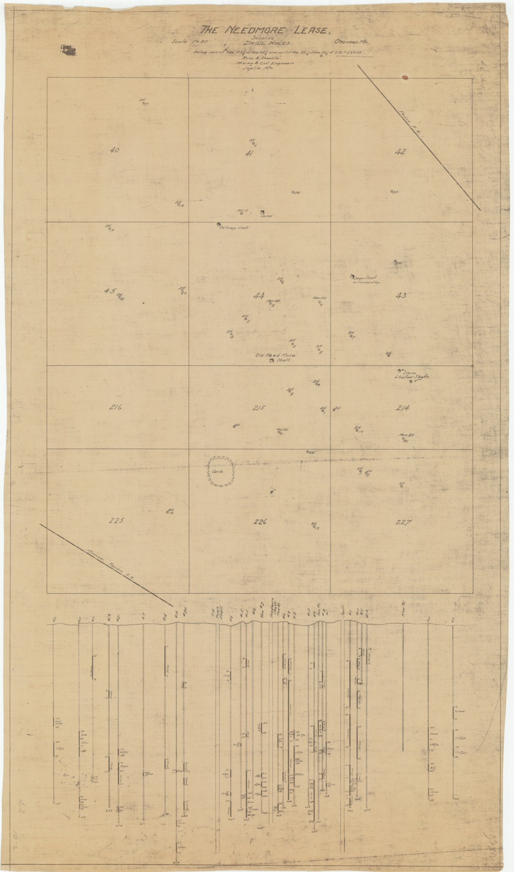
County: Jasper
Map Number: 00414
Mine Name: Needmore
Map Title: The Needmore Lease, Showing Drill Holes, Being Part of the NE1/4 of the NE1/4 and Part of the SE1/4 of the NE1/4 of S.36, T.29, R.33
Map Image: MAP IMAGE
Scale: 1"=30'
Township: 29N
Range: 33W
Section: 36
Commodity: zinc, lead
Company Name:
Author: Ruhl & Shanklin, Mining & Civil Engineers
Date: no date
Purchase: High-resolution electronic and paper maps are available for purchase by calling 573-368-2100