Missouri Geological Survey
Display Map Information
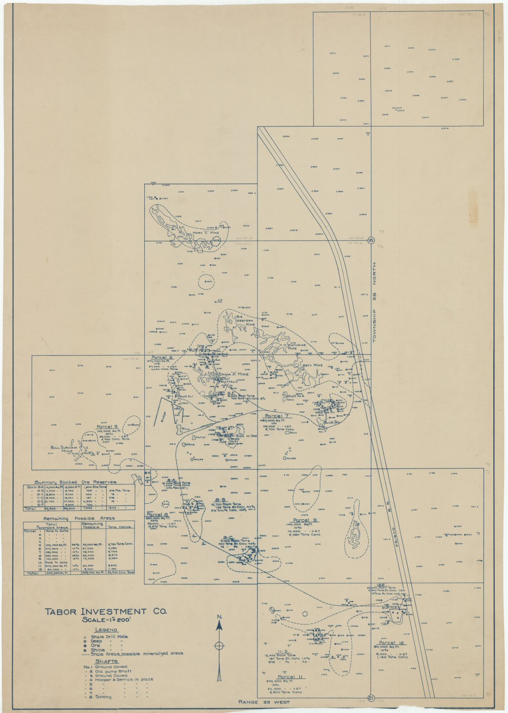
County: Jasper
Map Number: 00406
Mine Name: Bill Durham Mine, Emma "A" Mine, Mary "C" Mine, Big Western Mine, Katherine Mine, Katy Mine, Blue Jay Mine
Map Title: Tabor Investment Co.
Map Image: MAP IMAGE
Scale: 1"=200'
Township: 28N
Range: 33W
Section: 16, 17, 20, 21
Commodity: zinc, lead
Company Name: Tabor Investment Co.
Author:
Date: no date
Purchase: High-resolution electronic and paper maps are available for purchase by calling 573-368-2100