Missouri Geological Survey
Display Map Information
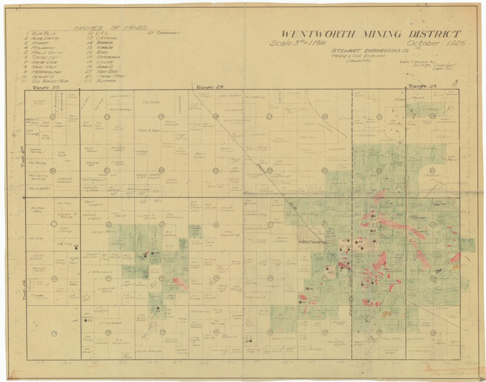
County: Newton, Lawrence
Map Number: 00324
Mine Name: *multiple mines
Map Title: Wentworth Mining District, October 1926
Map Image: MAP IMAGE
Scale: 3"=5280'
Township: 26N, 27N
Range: 28W, 29W, 30W
Section: ;01, 02, 08, 11, 12, 15, 17, 18; 01;;;
Commodity: zinc, lead
Company Name:
Author: Stewart Engineering Co.
Date: 1926
Purchase: High-resolution electronic and paper maps are available for purchase by calling 573-368-2100