Missouri Geological Survey
Display Map Information
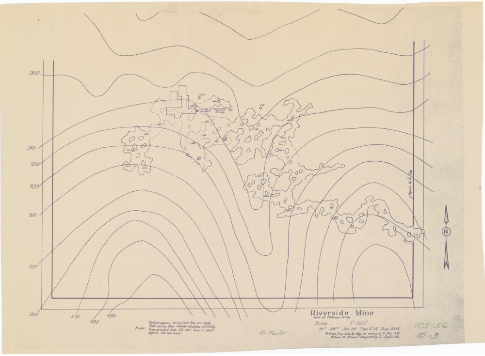
County: Newton
Map Number: 00312
Mine Name: Riverside Mine
Map Title: Riverside Mine, South of Fillmares Bridge
Map Image: MAP IMAGE
Scale: 1"=100'
Township: 27N
Range: 33W
Section: 29
Commodity: zinc, lead
Company Name:
Author: William M. Stewart Engineering Co. Joplin, Mo.
Date: >1937
Purchase: High-resolution electronic and paper maps are available for purchase by calling 573-368-2100