Missouri Geological Survey
Display Map Information
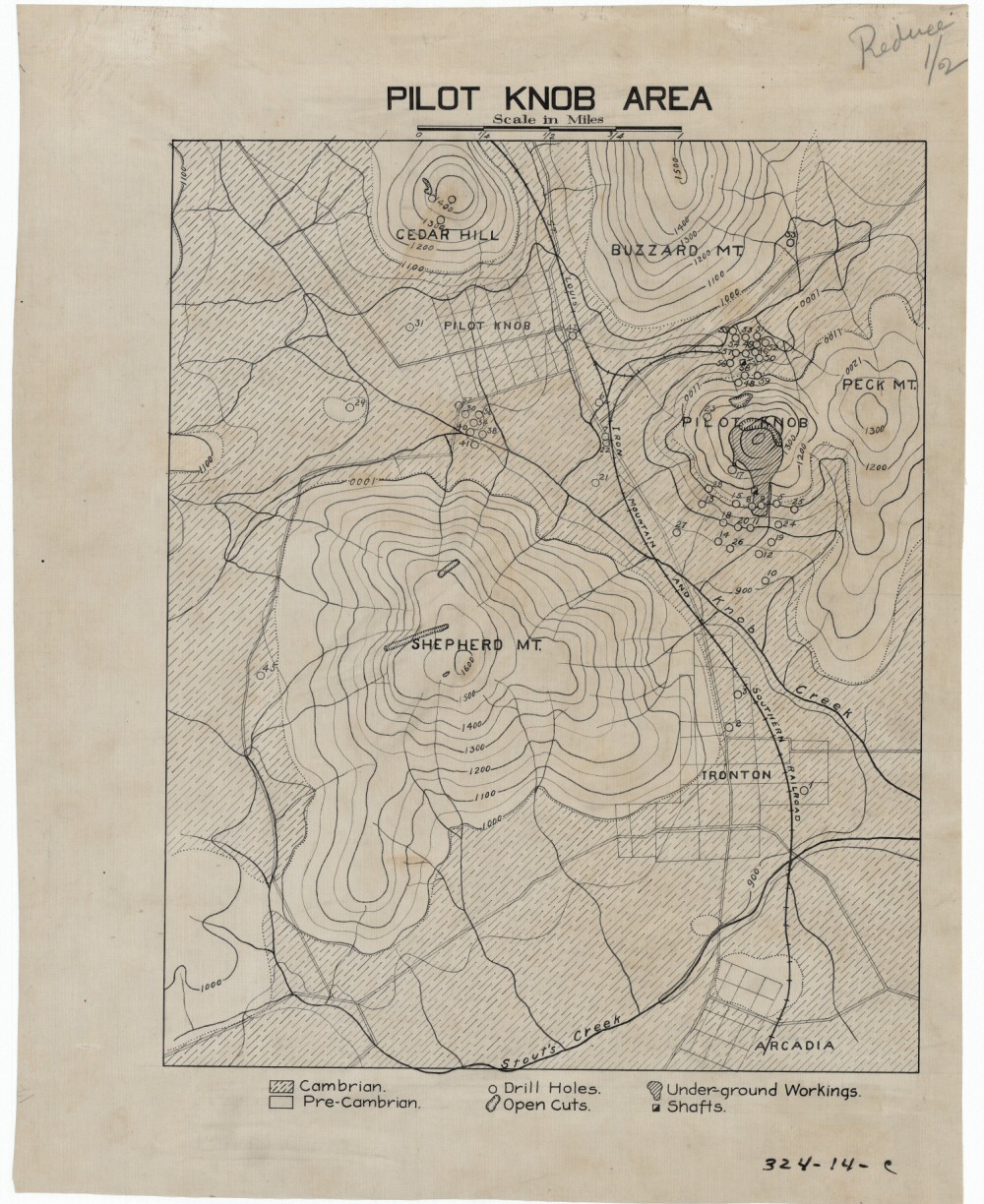
County: Iron
Map Number: 00218
Mine Name: Pilot Knob, Shepherd Mt., Cedar Hill
Map Title: Pilot Knob Area
Map Image: MAP IMAGE
Scale: 1"=0.25 mi
Township: 34N
Range: 03E, 04E
Section: 24, 25, 36; 19, 20, 29, 30, 31, 32
Commodity: iron (hematite)
Company Name:
Author:
Date: no date
Purchase: High-resolution electronic and paper maps are available for purchase by calling 573-368-2100