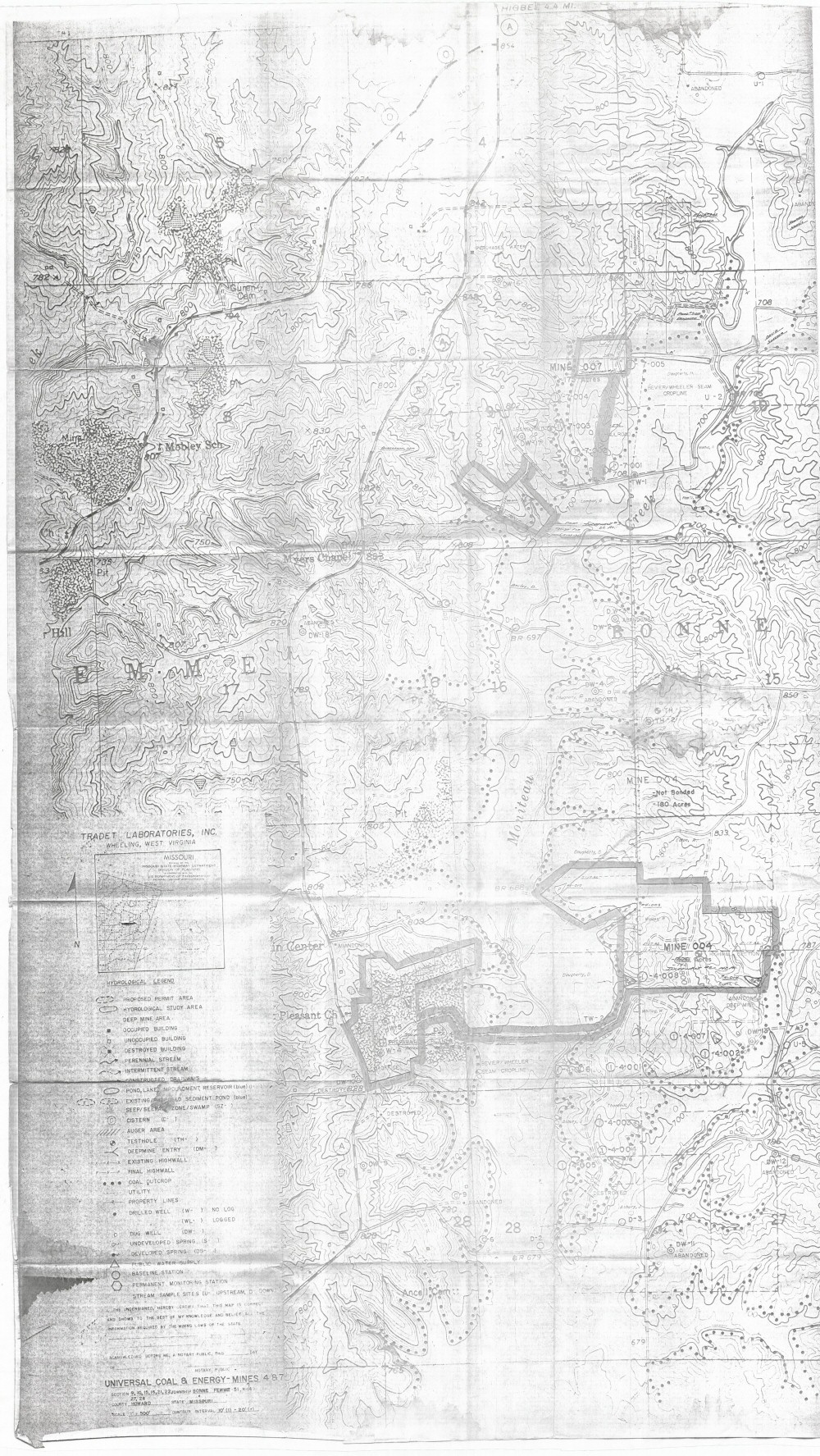
Missouri Geological Survey
Display Map Information
County: Howard
Map Number: 00217
Mine Name: Universal Coal & Energy Mines 4 & 7
Map Title: Universal Coal & Energy - Mines 4 & 7
Map Image: MAP IMAGE
Scale: 1"=500'
Township: 51N
Range: 14W
Section: 09, 10, 15, 16, 21, 22, 27, 28
Commodity: coal
Company Name: Universal Coal & Energy Co., Inc.
Author: Tradet Laboratories, Inc
Date: no date
Purchase: High-resolution electronic and paper maps are available for purchase by calling 573-368-2100