Missouri Geological Survey
Display Map Information
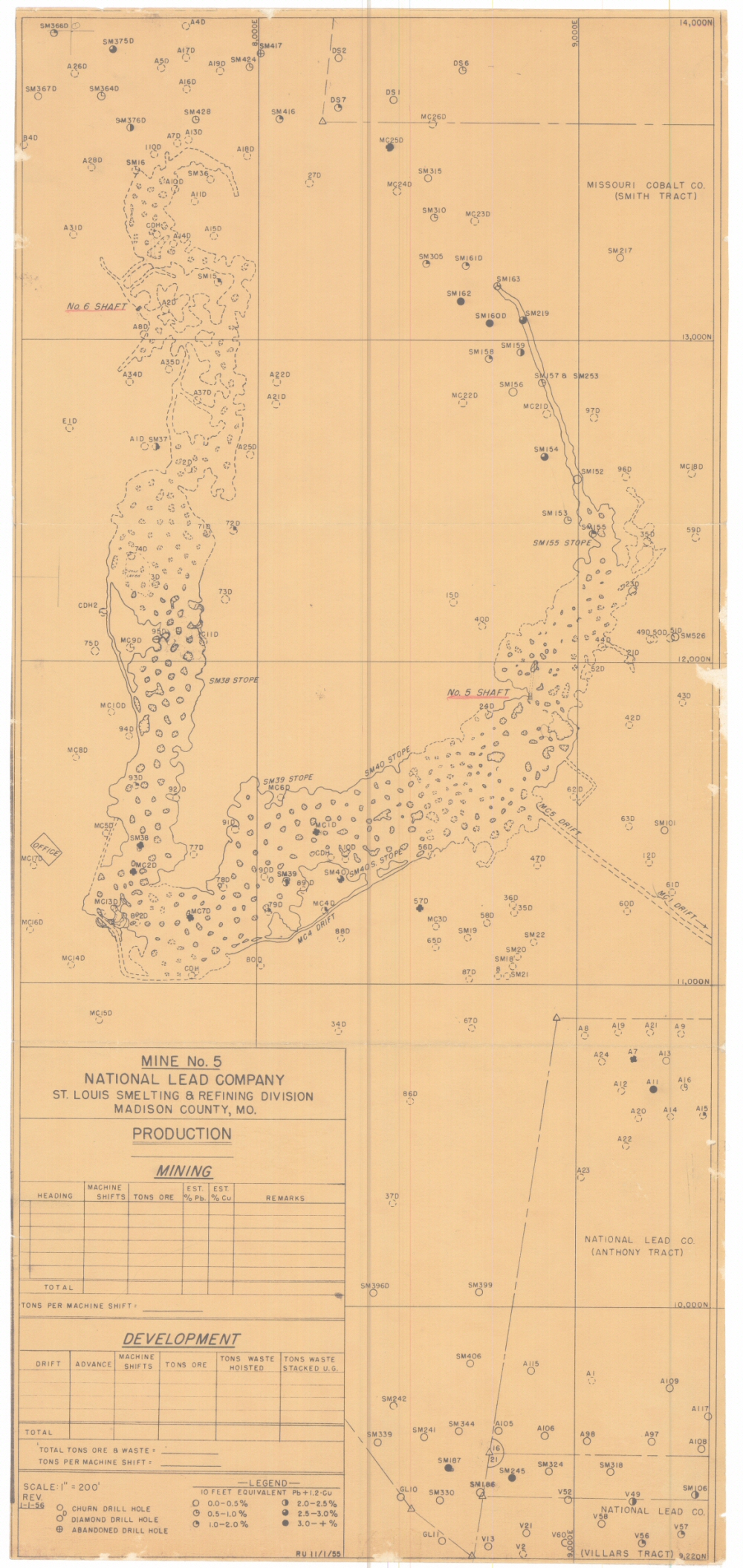
County: Madison
Map Number: 00213
Mine Name: Mine No. 5, Madison Mine
Map Title: Mine No. 5, National Lead Company, St. Louis Smelting & Refining Division, Madison County, MO
Map Image: MAP IMAGE
Scale: 1"=200'
Township: 33N
Range: 07E
Section: 16 (landgrant)
Commodity: lead, copper, cobalt, iron, nickel
Company Name: National Lead Company; Missouri Cobalt Co.
Author:
Date: 1956
Purchase: High-resolution electronic and paper maps are available for purchase by calling 573-368-2100