Missouri Geological Survey
Display Map Information
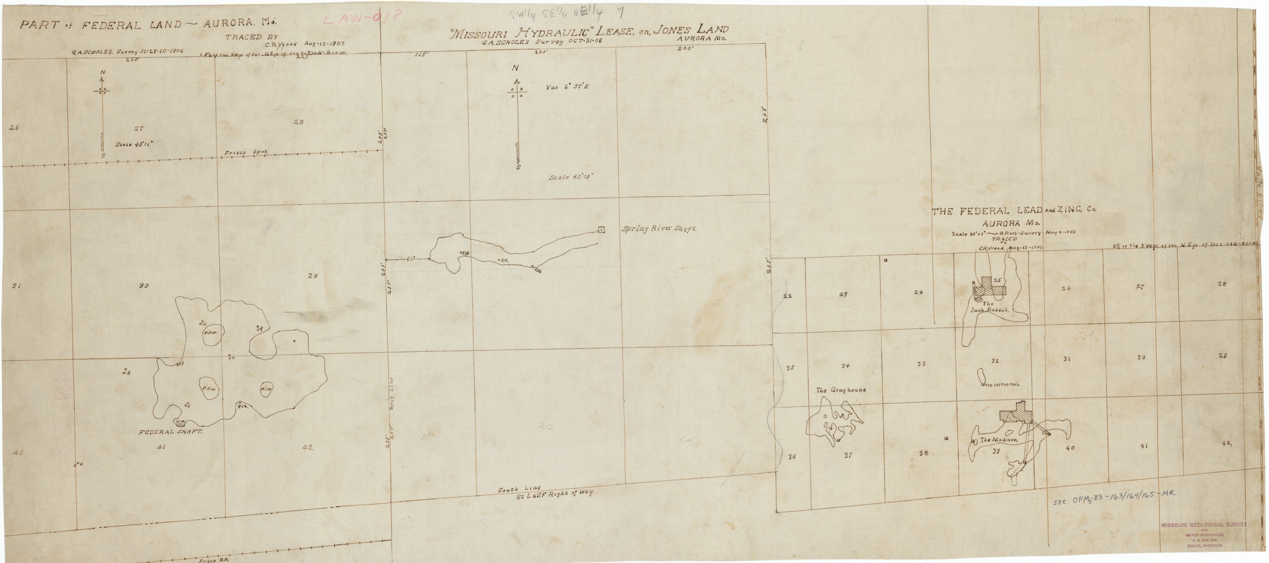
County: Lawrence
Map Number: 00065
Mine Name: Jack Rabbit, Grayhound, Madison, Cotton Tail, Spring River Shaft, Federal, others?
Map Title: Part of Federal Land, Aurora, Mo.; "Missouri Hydraulic" Lease on Jones Land, Aurora, Mo.; The Federal Lead and Zinc Co., Aurora, Mo.
Map Image: MAP IMAGE
Scale: 1"=40' and 1"=80'
Township: 26N
Range: 25W
Section: 07
Commodity: lead, zinc
Company Name: Federal Lead and Zinc Co.
Author: G.A. Scholes; R Root, C.R. Wood
Date: 1903, 1906, 1907
Purchase: High-resolution electronic and paper maps are available for purchase by calling 573-368-2100