Missouri Geological Survey
Display Map Information
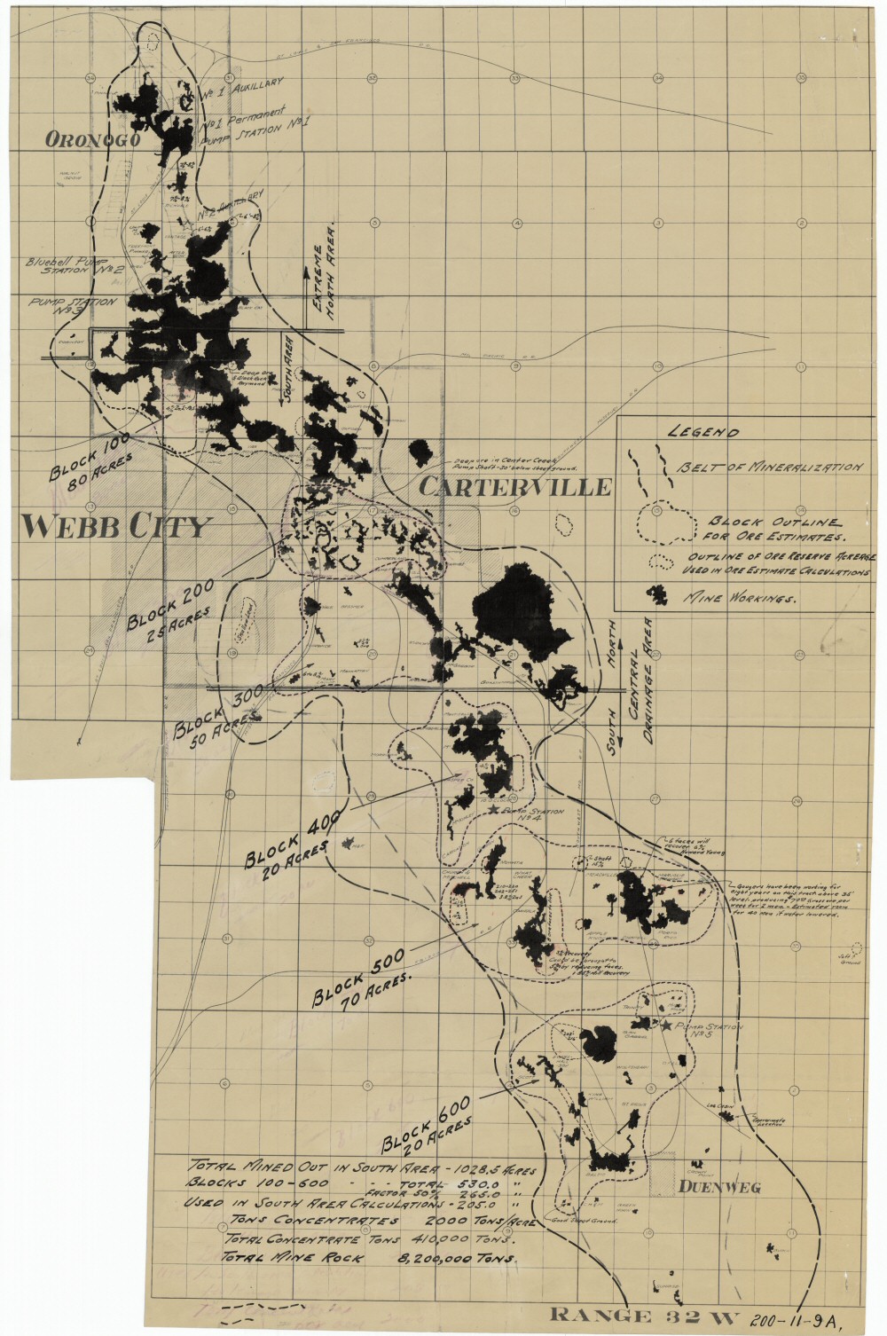
County: Jasper
Map Number: 00038
Mine Name:
Map Title: Central Drainage District, Jasper County, Missouri; Exhibit "B" (overlay)
Map Image: MAP IMAGE
Scale: 3.25"=5280'?
Township: 27N, 28N, 29N
Range: 32W, 33W
Section: 03, 04, 10, 11;;06, 07, 08, 16, 17, 18, 20, 21, 22, 28, 29, 33, 34; 01, 12; 31; 36
Commodity: zinc, lead
Company Name:
Author: William M. Stewart
Date: 1933
Purchase: High-resolution electronic and paper maps are available for purchase by calling 573-368-2100