Missouri Geological Survey
Display Map Information
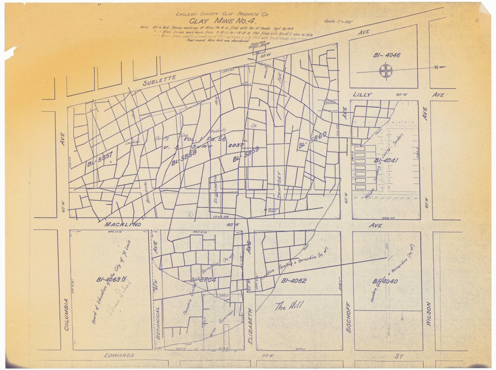
County: St. Louis City
Map Number: 00024
Mine Name: Clay Mine No. 4
Map Title: Laclede Christy Clay Mine Co., Clay Mine No. 4
Map Image: MAP IMAGE
Scale: 1"=100'
Township: 45N
Range: 07E
Section: 30
Commodity: clay
Company Name: Laclede-Christy Clay Product Co.
Author:
Date: 1919?
Purchase: High-resolution electronic and paper maps are available for purchase by calling 573-368-2100